Utah Scenic Byway 12 is one of the most breathtaking road trips in America and is widely regarded as one of its most scenic drives. Stretching 123 miles between Bryce Canyon National Park and Capitol Reef National Park, this All-American Road winds through colorful red rock canyons, alpine forests, dramatic sandstone cliffs, and charming small towns.
The drive is filled with unforgettable viewpoints, scenic pullouts, hiking trails, slot canyons, and unique geological formations. One of the most famous sections is The Hogback, where the highway follows a narrow ridge with steep drop-offs on both sides, creating one of the most spectacular drives in the American Southwest.
Whether you're spending a few hours or several days exploring Highway 12, this guide highlights my favorite stops, hidden gems, scenic viewpoints, and insider tips to help you experience one of Utah's most unforgettable road trips. Are you wondering if a Big Rig RV can travel on Highway 12? Route Decision
Utah Scenic Byway 12: Best Stops, Hogback & Travel Guide
Starting Highway 12 from the west entrance at Highway 89, here are the MUST-SEE sights!
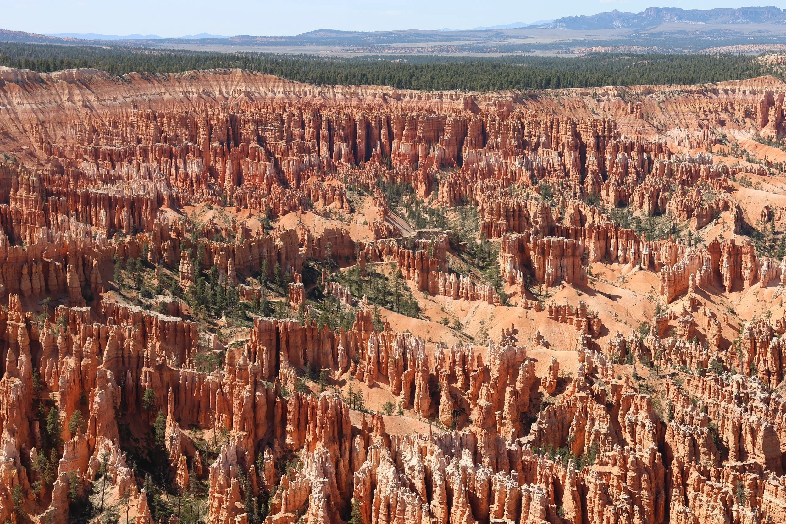
Mile Marker 7: Bryce Canyon City & Bryce Canyon National Park
Just beyond Bryce Canyon City, you'll reach the entrance to Bryce Canyon National Park, one of Utah's most unforgettable landscapes. While nearby Zion National Park is known for its towering sandstone cliffs, Bryce Canyon feels like stepping into a whimsical fairy tale. Perched on a high plateau at 7,700 feet, where snow can still fall into May, Bryce Canyon is home to the world's largest concentration of hoodoos.
These colorful rock spires, sculpted over millions of years by frost, rain, and erosion, create a breathtaking maze of natural formations unlike anywhere else on Earth. Whether you hike among the hoodoos or explore the canyon on horseback, every trail offers a new perspective of this extraordinary landscape. From sunrise to sunset, the changing light paints the orange, red, and cream-colored rock in constantly shifting shades, making every visit unique.
Why I love it: Hiking among 50-foot-tall hoodoos feels like exploring another planet. Every trail twists through towering rock spires and narrow passages, creating an unforgettable adventure that simply can't be experienced anywhere else.
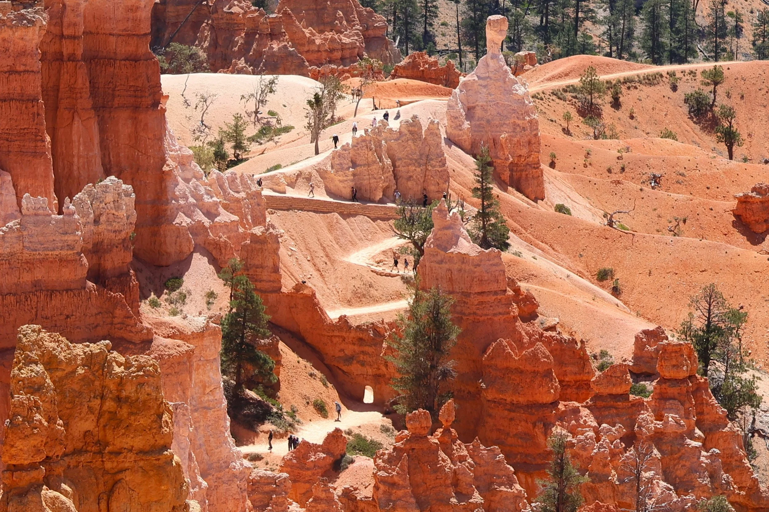
Mile Marker 21: Willis Creek Slot Canyon, Kodachrome Basin & Cottonwood Canyon Drive
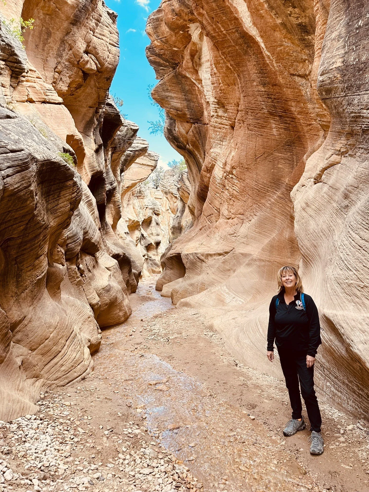
Just 6 miles from Cannonville, Willis Creek Slot Canyon is one of southern Utah's most accessible and family-friendly slot canyon hikes. The trail follows the gentle flow of Willis Creek through shallow water into a spectacular sandstone slot canyon, where towering walls and narrow passages twist and turn around every bend. It's an unforgettable way to experience the beauty of a Utah slot canyon without a strenuous hike.
Just down the road, Kodachrome Basin State Park is a colorful desert oasis filled with vibrant sandstone layers and towering sedimentary spires. During a 1948 National Geographic Society expedition, the park's brilliant colors inspired the name "Kodachrome" after Kodak's famous color film.
Why I Love It: This area offers three completely different adventures within a few miles of each other. Willis Creek captures the magic of walking through a slot canyon with very little effort, Kodachrome Basin showcases a landscape unlike anywhere else in Utah, and Cottonwood Canyon Road feels like driving across another planet.
Pro Tip: Stop at the Cannonville Visitor Center, operated by the Bureau of Land Management (BLM), to pick up maps, learn about current trail and road conditions, and discover nearby hiking opportunities.
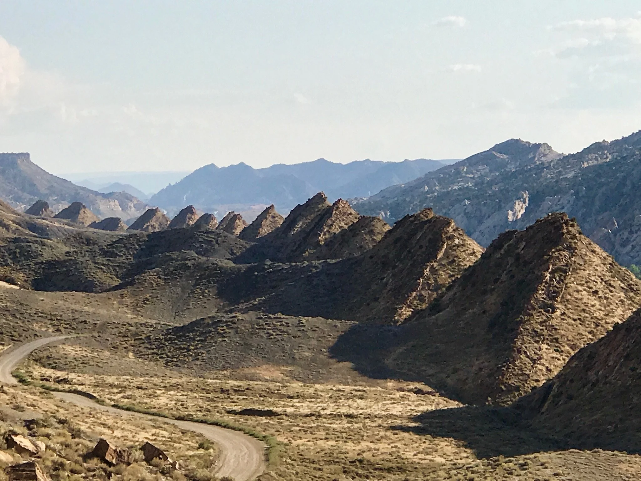
Feel adventurous? Drive Cottonwood Canyon Road, a 47-mile scenic dirt road through Grand Staircase–Escalante National Monument. The route winds past colorful cliffs, dramatic badlands, and the remarkable Cockscomb, where 160-million-year-old rock layers have been folded into steep, jagged ridges. The landscape is so unusual that it feels like driving across the moon. Be sure to stop at Cottonwood Narrows for a short hike through another beautiful slot canyon. When the road is dry, most two-wheel-drive passenger cars can travel it comfortably. Although you'll encounter occasional ruts and washboard sections, the road is generally well maintained. Avoid driving it after heavy rain, as portions can quickly become muddy and impassable.
Mile Marker 60: Escalate, Utah
Welcome to the small, unique, charming ranching town of Escalate! Stop at Escalate Mercantile for lunch; pick up a Turkey and cranberry sandwich, Walnut Banana Bread, and a Blueberry Muffin. Nemo's Drive Thurs is a good choice for a burger, fries, and a Cookies and Cream milkshake!
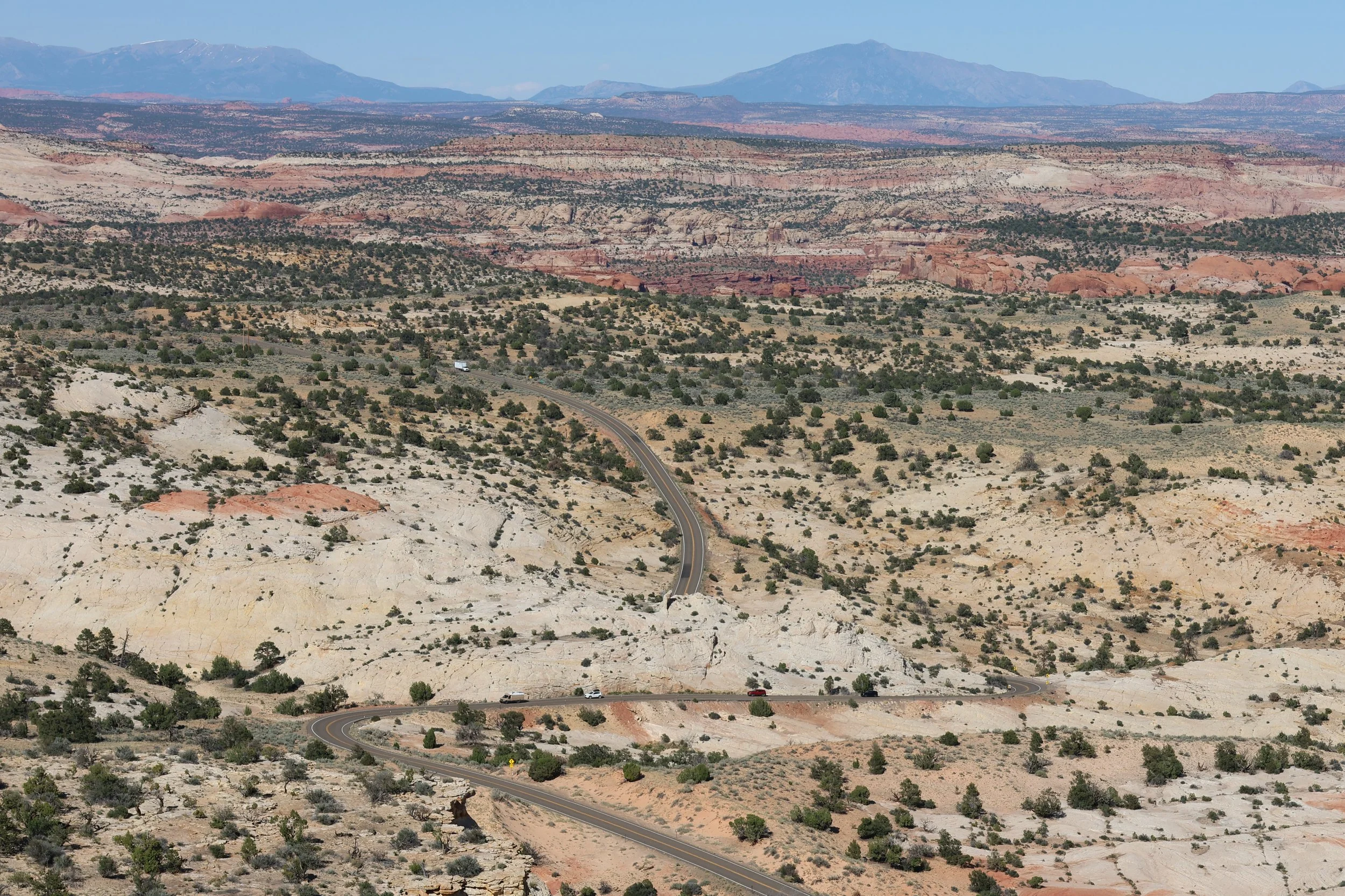
Mile Marker 65: Head of the Rocks Overlook
Head of the Rocks Overlook is one of the most spectacular viewpoints along Utah Scenic Byway 12. From this breathtaking vantage point, you'll enjoy sweeping panoramas of the Escalante Canyons—a vast maze of colorful slickrock, deep sandstone gorges, and winding canyons stretching to the horizon. The layered landscape reveals the immense scale and rugged beauty of the Grand Staircase–Escalante National Monument, making this a favorite stop for photographers and anyone who appreciates unforgettable desert scenery.
As you continue east, Scenic Byway 12 begins its steep descent toward the Escalante River, dropping nearly 1,000 feet along grades reaching 14%. Each switchback reveals a new perspective of the surrounding canyon country, offering a firsthand appreciation for both the remarkable engineering of the highway and the breathtaking scenery that has earned Scenic Byway 12 its reputation as one of America's most unforgettable drives.
Why I Love It: This overlook captures the vastness of southern Utah in a single view. You can stand quietly, take it all in, and truly appreciate how wild and untouched this landscape remains.
Mile Marker 73: Kiva Koffeehouse
Mile Marker 73. Kiva Koffeehouse is a charming coffeehouse perched on a cliff, offering breathtaking views of the canyon. It's an excellent destination for lunch, offering quiche, Spanish Tortilla, and cappuccinos, complete with pastries like tiramisu, cream puffs, or a cranberry scone, all while sitting on the outside porch.
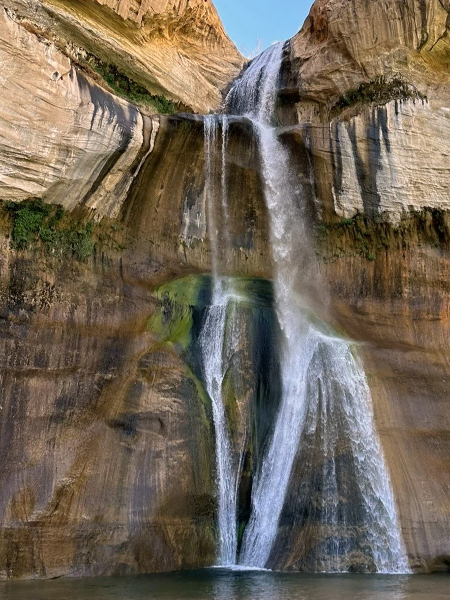
Mile Marker 75: Lower Calf Creek Falls
One of the most popular hikes along Utah Scenic Byway 12, Lower Calf Creek Falls is a spectacular 6-mile round-trip adventure that rewards hikers with a breathtaking 120-foot waterfall cascading over colorful, mineral-streaked sandstone cliffs into a cool, emerald pool below.
The well-marked trail follows Calf Creek through a scenic desert canyon, winding across sandy washes, rocky terrain, and shaded groves of cottonwood trees. Along the way, watch for ancient Fremont petroglyphs carved into the canyon walls near trail marker 8, offering a fascinating glimpse into the area's rich cultural history. Keep an eye on the crystal-clear waters as well—brown trout are often visible swimming in the creek.
With its combination of striking desert scenery, archaeological treasures, and one of southern Utah's most beautiful waterfalls, Lower Calf Creek Falls is widely considered a must-do hike along Scenic Byway 12.
Why I Love It: The payoff is unforgettable. After hiking through the desert, rounding the final bend to see a 120-foot waterfall pouring into a cool oasis feels almost surreal. It's one of those hikes that's just as enjoyable for the journey as it is for the destination.
Mile Marker 79: Welcome to "The Hogback"
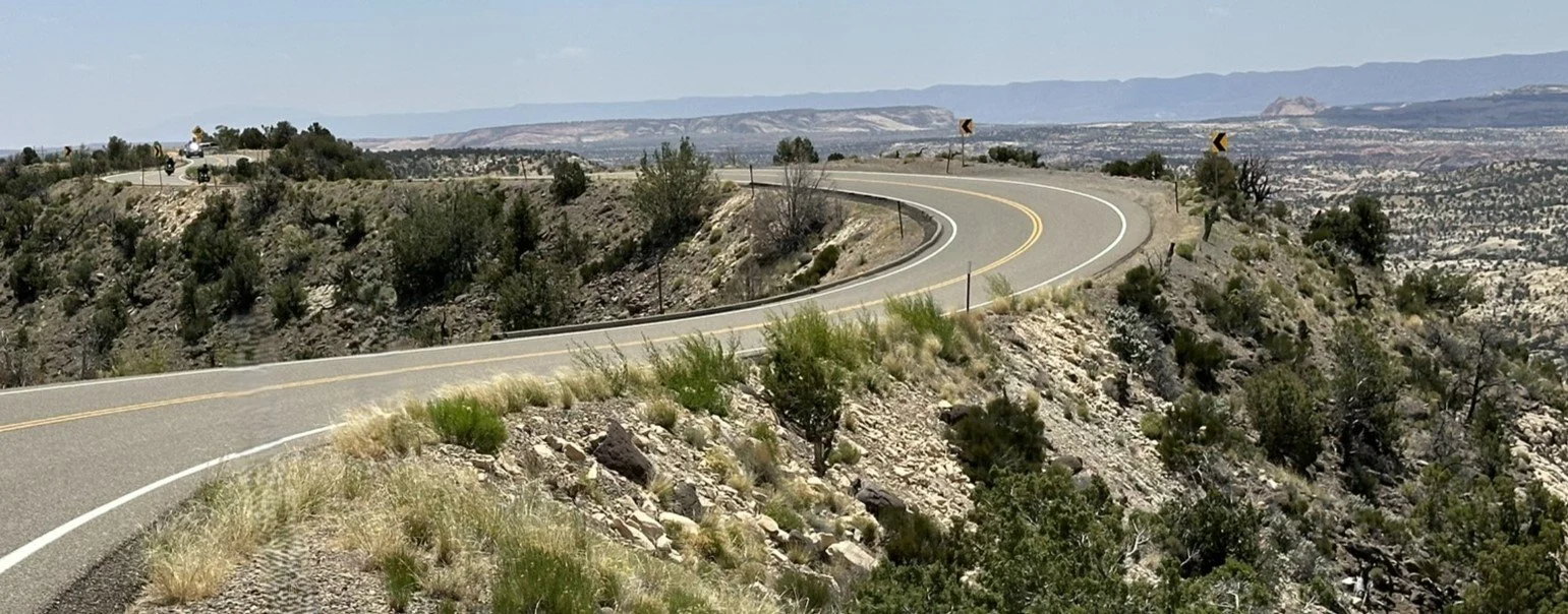
The Hogback—the most famous stretch of Utah Scenic Byway 12 and, for some drivers, its most exhilarating. This iconic ridgeline is one of the highlights of the drive, offering breathtaking 360-degree views that make it one of America's most memorable scenic highways.
After climbing a steep 14% grade out of the Escalante River canyon, the road reaches a narrow ridge where the landscape suddenly opens in every direction. For nearly a mile, Scenic Byway 12 follows the crest of the ridge, with dramatic drop-offs into colorful sandstone canyons on both sides. Although the drive may feel intimidating at first, the roadway is well engineered and provides a comfortable driving experience. Several scenic pullouts along the route allow you to stop safely, soak in the panoramic views, and capture unforgettable photographs.
Why I Love It: Few roads make you feel so connected to the landscape. Driving along the spine of The Hogback, with expansive canyon views stretching for miles in every direction, is an experience you'll remember long after your Utah road trip ends.
Planning Tip: There are several large pullouts along the ridge for enjoying the view.
Mile Marker 82: Hell’s Backbone Grill
In Boulder, stop by Hell’s Backbone Grill for a meal. This farm-to-table restaurant, famed for its ethical, sustainable practices, has one of the highest Zagat ratings in Utah and multiple James Beard accolades. Reservations may be required.
After the town of Boulder, the drive to Torrey, 37 miles, climbs and ascends the Boulder Mountain Pass at an elevation of 9,600'. From its elevation, the mountain offers panoramic views of aspen trees alongside the spectacular rock formations of Capitol Reef National Park and the Grand Staircase-Escalante National Monument. There are plenty of scenic viewpoints and overlooks.
Published: 2026